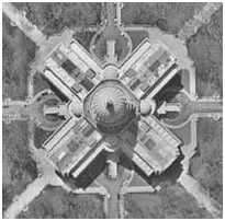
The Wisconsin Department of Transportation (WisDOT) Surveying and Mapping Section has recent and historical vertical aerial imagery of the entire state of Wisconsin to assist in the design of highways and other transportation improvements. This aerial imagery is available for purchase through the WisDOT Surveying and Mapping Section. WisDOT staff and consultants may provide a valid WisDOT project ID rather than payment.
How to order
1. Assemble the following information:
- Location: Please define by county, township, range and section(s) information
or email a detailed map with the area outlined. If you need assistance locating your area, please call (608) 246-5392 or (608) 246-5397.
- Timeframe: What year(s) you are interested in.
- Your name, phone number and/or email address
2. Provide the above information to the Photogrammetry Unit:
Email:
DOTAerialImageryRequest@dot.wi.gov
Telephone: (608) 246-5392 or (608) 246-5397
Fax: (608) 245-8959
Please call for an appointment
Wisconsin DOT - Truax Materials Lab (map to Truax)
3502 Kinsman Blvd. Madison, WI
Monday - Friday, 8 a.m.-2 p.m.
WisDOT will research your area(s) of interest, then contact you via telephone or email with information about the years and scales available for your request.
3. Select the type of product you want:
-
Contact prints, original scale, 10" x 10" size for $20 each
-
Enlargements, up to 36" x 36" size $20 for each
-
Digital imagery, original scale, 600 dpi resolution, .jpg or .tif format for $20 each
4. Send your payment - prepayment by check or money order is required. Shipping via 1st class US Postal Service is $4 per order. Make checks payable to WisDOT and mail to:
Photogrammetry Unit Open Records Request
Wisconsin Dept. of Transportation
Surveying & Mapping Section
3502 Kinsman Blvd.
Madison WI 53704
Questions about the content of this page:
Photogrammetry Unit,
DOTAerialImageryRequest@dot.wi.gov